Chapter 8: First Passage: Scourie to Madeira tells the story of our first lengthy passage (1,800 miles, 34 days). I describe how we settled into living on the boat, sailing her 24 hours a day. At the time coping with the relentless bad weather for the first few weeks, and navigating our way to the small island of Madeira, out in the Atlantic 440 miles west of Morocco.

In these Notes for Chapter 8: Our departure from the Outer Hebrides; the Flannan light mystery; farewell to St Kilda; the off-shore course; coping with heavy weather; photos not in the book; our initial navigation; and our approach to Madeira.
As explained in the book, we chose not to take the inshore route south down the Irish Sea. Instead we planned a route well offshore.
Anticipating the prevailing strong southwesterly winds and current. We would sail west initially from Scotland out into the Atlantic on a port tack. Then, we would turn south onto a starboard tack when we judged we had enough sea room to clear Ireland,
But as it happened, we departed with an unexpected fair north-easterly wind. So once clear of the Butt of Lewis (the northerly end of the island of Lewis), we could turn southwest and head first for the Flannan Isles, then St Kilda.

The Flannan Island lighthouse mystery: It’s remote and uninhabited today. The Stevensons built the lighthouse on the Flannan Isles between 1895 and 1899. The light had just been automated in 1971 when we passed by. It would be unknown today were it not for the mysterious disappearance of the three keepers in 1900. A lighthouse service ship was sent to investigate the reported failure of the light. They reported:
A dreadful accident has happened at the Flannans. The three keepers, Ducat, Marshall and the Occasional have disappeared from the Island… The clocks were stopped, and other signs indicated that the accident must have happened about a week ago. Poor fellows, they must have been blown over the cliffs or drowned trying to secure a crane.
They further noted evidence of a violent storm;
On Eilean Mòr, the men scoured every corner of the island for clues as to the fate of the keepers. They found that everything was intact at the east landing. But the west landing provided considerable evidence of damage caused by recent storms.
A box at 33 metres (108 ft) above sea level had been broken, and its contents were strewn about. Iron railings were bent over, the railing by the path were wrenched out of their concrete base. A rock weighing more than a ton had been displaced. On top of the cliff, more than 60 metres (200 ft) above sea level, turf had been ripped away as far as 10 metres (33 ft) from the cliff edge.

No trace of the keepers has ever been found. More.
Aboard The Aegre, as we steadily drew past the small rocky islands, I read all about it in the blue hardcover NW Scotland Pilot Book. What tragedy happened here in this bleak place 73 years before?
Long after, in 2018, a British film, The Vanishing, was made based on the mystery, proposing a dramatic (and far-fetched, in my opinion) story behind their disappearance. I’ll stick with the conventional thinking.

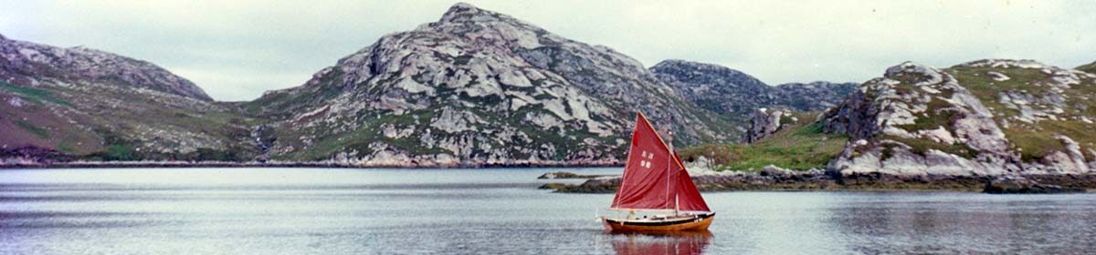
From the Flannan Isles, we set a course for the last island outpost west of the British Isles, the lonely islands of St Kilda.
Departing St Kilda, last sight of the British Isles: Everyone in Melbourne, Australia, knows St Kilda; it’s an inner suburb of Melbourne on the edge of the large bay that is Port Phillip. At one time, a sort of Coney Island to the city. Today it’s a dynamic beachside entertainment area rapidly becoming gentrified. Its name comes from the schooner, Lady of St Kilda, famously moored off the beach in 1841.
Fewer Melburnians will know of the original islands of St Kilda, in the Outer Hebrides, that we now had dead ahead of us on the horizon. From the Pilot Book, I read that a community existed here for at least 4,000 years, living off the dense colonies of gannets, fulmars, and puffins for food.
The final 36 residents voted to leave the island in 1930 believing their life there was no longer sustainable. As we neared the main island in 1973, sailing past not far offshore, I used our binoculars to survey the ruins of the crofts in the one-time village and wondered about the hard life living there.

In 1973, the islands seemed bleak and lonely to us. They were the last vestige of the British Isles as we headed out south-west into the Atlantic, and they soon disappeared into the dark grey gloom of the evening.
Today they are a buzzing World Heritage site., and you can visit them in 5 star luxury. Well almost.
The off-shore course: The north-easterly wind held for a while before inevitably bad weather came in from the southwest. Unwilling to repeat the experience of the Spanish Armada and explore the west coast of Ireland more intimately, we turned to tack further out to the west to give that wild coast plenty of clearance.

In those early weeks of rotten weather, battling our way west or south, we lived each day for the detailed Brisih Shipping forecast. The calm, modulated tones of the announcer were often in desperate conflict with the reality a foot away on deck as we slowly worked our way from Malin to Rockall, then Shannon and Sole.

Coping with heavy weather
As I relate in the book, we coped with this bad weather with a sea anchor, by heaving to and lying a-tri.
Sea Anchor: We had with us a sea anchor that Kip Gurrin, in Orkney, had made for us out of flax, with a steel ring to hold it open. For those not familiar with sea anchors, no, they are not heavy iron things with a very long warp to anchor a vessel to the bottom when out at sea, but rather a drogue-like affair, a bit like a windsock, but made of tougher material like heavy canvas.
Placed in the sea and attached to a small vessel on a long warp, they sit just below the surface, their purpose being to limit the wind-blown drift of the vessel, acting as a brake. Lifeboats are commonly equipped with them. Normally, they are attached to a small vessel’s bows with the intention of holding the vessel facing into the wind and waves so the vessel doesn’t sit broadside on to the waves and risk being overwhelmed by them. Wikipedia has a page on Sea anchors.

In the book, I describe how we set our sea anchor in the first of the gales that swept over us to the west of Ireland and how, with the windage of the bare mast, the boat lay at an angle to the wind, the waves striking us on one side of the bow. Our drift to leeward was very slow, but periodically the boat would be violently jerked as the line to the sea anchor suddenly tightened due to the combination of waves. I let out more warp to try to reduce this, and later tried sinking the warp with chain to act as a spring.
Heaving-to: We also tried heaving to with various combinations of our storm sails.
Traditionally this means stopping the boat in the water by setting two small sails, one to counteract the drive of the other, with the tiller lashed so that the boat ‘sails’ slightly forward into the wind, but then loses drive from the mainsail, the wind then pressing on the jib so the boat sails backwards, until some drive is restored in the mainsail, causing it to sail forward a little, but into the wind. Repeated endlessly, the effect being that the boat sits almost stationary in the water, with the wind and waves coming onto one side of the other of the bow, while way is made slowly, at about 90 degrees to the wind.

The Aegre would heave to under the reefed storm mainsail and tiny flax jib, but as the wind strength increased, we needed less sail and found she sat even better under just the fully reefed storm mainsail alone, with the tiller lashed down to balance the movement of the boat forward and aft, sometimes known as lying a-tri.
Lying a-tri: Like being hove-to, the small flax, reefed mainsail provided enough thrust to maintain control of the boat, giving just enough drive to move the boat slowly forward, the action of the lashed rudder then turning the boat toward the wind, so wind pressure in the sail, and therefore drive, was reduced. The boat would stop and start to sail backwards, and again the rudder would act to turn the boat slightly off the wind, increasing drive in the sail again. So the boat stops, and starts sailing forward slowly again.
The net result is the boat being almost stationary, facing slightly to one side of the wind (and oncoming waves) and slowly making way across the wind and slightly downwind. With little actual wind in the small sail, the boat remained upright and required no further attention from us. It was a safe and comfortable way to pause and let bad weather pass.
This became our favoured rig in heavy weather in contrary winds and seas. The Aegre would sit comfortably, feeling relatively unstressed, requiring no attention, taking the wind and seas on one bow or the other, heeled a little but steady, only the occasional wave breaking across the boat from the bow.
In strong winds and seas from a favourable direction, The Aegre was most comfortable under just the tiny flax storm jib alone (the mainsail and spars lashed down on deck), running slowly (<3 kn. I estimate) before or a little across the wind and seas, although this strategy eventually failed in the Pacific, as I later tell.
Photos not in the book: Taking photos (on our 12-shot Instamatic camera) was not in our thinking during the first few weeks as we battled southwest against gale after gale. But once south of Ireland, the wind diminished, the seas went down and a hazy sun broke through. Then the camera came out, together with all our sodden clothes from below. As a light northerly came in, life improved a lot.
, storm jib on top of lifering on hatchcover.")


 have the radio out in the cockpit.")


Astro-navigation: the plotting of an earthly position using the measured altitude of the sun and stars
Looking back, years later, with tens of thousands of sea miles behind me, I’m surprised how confident I seemed about astro navigation with so little experience of it. Certainly I had studied and practised rigorous coastal navigation, studied the theory of astronavigation and was quite familiar with optical instruments. I knew how to calculate latitude from a noon sun sight and determine position lines (on a chart) from sun sights taken some hours before or after local noon.
At the same time I understood the theory of calculating a position from a series of star sights at dusk or dawn and had ensured we had all the necessary reference material aboard, the current Nautical Almanac and the Air Sight Reduction tables (Vol 2) for sun sights. I had the lovely little (half-size) sextant and, having studied Optics in London, was very familiar with general handling, calibrating, and using such an instrument. But was all that enough?

Our one real equipment weakness when we started out was the lack of a proper chronometer to measure the needed GMT time of each sight accurately. I explain how we progressively addressed this elsewhere on this website here.
In hindsight, we had all we needed for astro navigation, I just lacked the experience. But I thought once we got out to sea and needed to put it all together, I’d work it out. Ah youth!
As it happened, we didn’t see the sun or stars for the first few weeks anyway, but we did have Radio Direction Finding.
Radio Direction Finding (RDF): In those days (post-second World War and before the public availability of GPS (Global Positioning Satellite Systems), Radio Direction Finding (RDF) beacons was a vital navigational aid. It’s still in use today. RDF transmitting stations are in prominent positions along coastlines and at frequently used destinations. They are a sort of radio lighthouse, transmitting a constant signal such as a short Morse code identifier, usually on the radio ‘Long Wave’, which can travel long distances over the horizon.

A receiving radio being physically turned or a small loop aerial attached to it being turned, can determine the relative compass bearing of the source signal. A line can then be drawn along this bearing from the source transmitter on a chart. If the bearing of a second signal is also determined and a line drawn, where the two crossed is indicative of the position of the receiver.

No, it isn’t very accurate, but a great deal better than nothing. Our little Hitachi transistor marine receiver had a rotating aerial on top for this very purpose. As I write in the book, it proved invaluable.
Approaching Maderia
As I write in Chapter 8 of the book, as we approached Madeira, we decided to sail into the lee of the northerly wind behind one of the neighbouring islands, Porto Santo, and pause for about 24 hours. This enabled us to arrive in Funchal on a Monday morning, not a Sunday (saving possible weekend arrival fees), and gave us time to prepare the boat and ourselves for arrival. This worked out well.

Back to The Aegre Voyage Chapter Notes homepage.
See the book for the whole story.